
Another Storm Late Monday into Tuesday with Rain and Snow
After a sunny, albeit windy, Christmas Sunday with temperatures above normal for the entire region another storm system is gathering itself over the state of Texas tonight. This storm system will take aim on the lower Ohio Valley late Monday night and overspread the entire region on the day Tuesday. While most areas will start as rain fairly high confidence exists that several hours of snow will fall across the area as Tuesday wears on. Places in northern Indiana and northwestern Ohio could pick up several inches of snow; however, predicting accumulations are tough. With the relatively warm ground and surface temperatures expected to be a bit above freezing accumulations are expected to be minor. The caveat with this storm is that models have tried to trend a bit colder with each run.
First off for Christmas Monday expect mostly sunny skies with temperatures in the middle 40s in the north to near 50 in the south. With a light south wind it will feel quite nice outside in the sunshine. By late in the afternoon into evening clouds will rapidly spread in from south to north bringing with it rain by late evening into early morning across the southwestern portions of the Ohio Valley. By the mid morning hours on Tuesday rain will overtake the entire region with a slow and gradual change to snow from northwest to southeast during the day. Tuesday morning will find temperatures starting in the lower to middle 30s with only slight warming. Highs in the southern reaches will make it to near 40 degrees before falling. As we move north of the Ohio River in southeast Indiana and southwest Ohio temperatures will crest in the upper 30s before beginning to fall during the early afternoon. Farther north along the I-70 corridor and points north, temperatures appear to hold steady in the lower to middle 30s throughout most of the day.
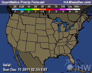
Amounts of .50 to over 1.00″ of Liquid Expected From Storm System; Courtesy of NCEP

This system, as most storms have produced all year long, will hold plenty of liquid. Everyone should see well over .50″ of precipitation with some areas in the southeast possibly receiving over 1″ of precipitation. The amounts anticipated is the reason why places that change over quickly could see several inches of total snow. To the relatively new weather follower, total snowfall is not accumulating snowfall, it just simply means the total amount of snowfall that is produced from a system. It is not out of the question that places in northern Indiana and northwest Ohio could see over 4″ of snowfall during the day Tuesday, while places farther south and east could see 1 to 2 inches of snowfall.
As for accumulations based on some of the model precipitation outputs over a three to six hour period, I expect an inch or two could accumulate on back roads, cars, grassy areas, and super cooled objects if not slightly more for northern and central areas. Yet I do not see busy roads, thoroughfares, and highly traversed areas being able to accumulate snow. For places farther south, around an inch can accumulate in those favored spots before the storm begins to wind down Tuesday evening. A few snow showers linger into Wednesday morning before drier air pushes into the region. So while this snowfall season has struggled to get off the ground it does appear that Tuesday will be rather wintry for the entire region.
Long Range Suggests Cold Pattern for Now; Courtesy of NCEP
Taking a quick peek to the long range, a massive battle exists in the models. On certain days models show very mild air flowing into the United State and settling into the Ohio Valley pretty much ensuring the rain and mild stretch the area has been in. Then on other runs the exact opposite ensues with a major eastern trough, cold air, and several snow threats. This pattern simply continues to play havoc with forecasting. Coming from someone with over 20 years of experience, I can admit this is one of the toughest patterns I have witnessed. All signs pointed to a roaring warm start to January and almost on a dime, models show a strengthening polar vortex leading to quite the cold start to open the 2012 year. I will be watching with anticipation to get a better handle on the upcoming pattern.
For instant updates check me out at twitter @ http://twitter.com/OhioValleyWx or on facebook @ http://www.facebook.com/OVWeather
By Weather Specialist Josh Ketchen


You must be logged in to post a comment Login