
Log Jam in the East, Katia Intensifying
What a change the Ohio Valley has and will witness over 48 hours! From temperatures in the middle 90s to lower 100s on Friday and Saturday, to 70s and 80s today, to 60s to low 70s for the rest of week will be a big swing. It is meteorological fall after all, so why expect anything different. A major trough is inching its way east across the Midwest and into the Ohio Valley today. Add to the fact Tropical Storm Lee is in the Gulf and a rapidly intensifying hurricane is getting into the western Atlantic, you have the makings of a stagnant pattern for the eastern United States.
Labor Day Highs in the Mid 60s to Low 70s; Courtesy of pro.accuweather.com
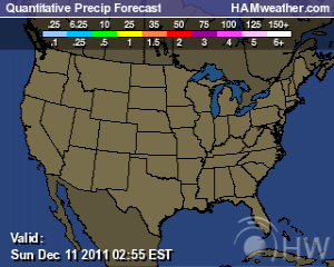
To start off with our weather, the last serious heat blast for the region has come and is now exiting today. Numerous showers and thunderstorms have occurred with a few more tonight and into early Labor Day but with Tropical Storm Lee sitting over the far northern Gulf it is helping to slow the front from pushing through. What complicates matters more is that a piece of energy from Lee will eject north slowing the front down even further. You might remember from the last post I cautioned many to not buy into sunny and nice weather for Labor Day and the upcoming week because of the system and that indeed has come to fruition. While Labor Day will not be a wash out and by the afternoon things could be dry for most, clouds and isolated showers are possible, much different than the sunny and low to mid 70s that many had forecasted through early Saturday.
Expanding out farther into the week, the remnants of Lee will become cut off from the main flow and sit and spin over the southeastern United States for several days. If we add to the potential of a new piece of energy to sit over the Gulf and mature into another tropical disturbance, the stage will be set with a chance of rain for the next week to 10 days. A second trough is poised to drop down into the Ohio Valley by the end of the work week; however, we now have to address potential East Coast threat Katia.

Certain model runs have Katia hitting the East Coast of the USA while others have it staying just off shore. The role Katia can and will likely play is to halt the eastward progression of the trough from advancing east keeping things unsettled for the Ohio Valley. So where does the moisture of the remnants of Lee and the potential new storm in the Gulf go? You guessed it, into the Ohio Valley. Forecasting and timing of specifics are not clear at this time because the tropics can go against the normal progression of weather but with a good amount of certainty showers and scattered thunderstorms can occur almost every day over the next week. Check your local television markets or media outlets to keep up with the weather to adjust plans if need be with the rain.
For the eastern and southeastern Ohio Valley readers a Flash Flood Watch has been issued due to the potential of excessive rainfall from the first piece of energy from Lee. The watch is in effect through late tonight but there is a pretty good chance that this watch will be extended with the threat for heavy rains continuing through at least Wednesday. I will stress thing again, it is a fluid situation because the exact remnants are not yet known so please stay tuned to media outlets for the latest information.
National Hurricane Center’s Projected Path of Katia; Courtesy of National Hurricane Center
A brief word on increasingly strengthening Katia, she is now a category 2 hurricane on the Saffir-Simpson scale. Katia has struggled for several days to find its own identity. With battling a trough to the north in the middle part of last week, to shear over the last couple of days conditions have finally improved to allow for this hurricane to explode. Katia should obtain major category strength later tonight or early tomorrow as it moves northwest. As mentioned at the top, a few model runs sit a massive and deep Katia just off the East Coast by the end of the work week and then begin to bring it north to affect the Carolinas. Others have it staying just offshore but close enough to feel the affects of rip currents, some outer squalls, and rough seas. This is just adding to the difficult forecast for the eastern half of the United States this coming week. One thing for sure is that this is not a boring pattern by any means.
The heat may be gone but the heat is certainly turned up to deliver a good forecast for you, the loyal reader.
For instant updates check me out at twitter @ http://twitter.com/OhioValleyWx or on facebook @ http://www.facebook.com/OVWeather
By Weather Specialist Josh Ketchen


You must be logged in to post a comment Login