


Friday’s Surface Map
Courtesy of The Weather Channel
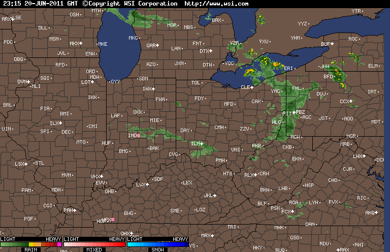
The relatively brief lull in the rain will be just that brief. Some places are already seeing a few showers scoot across the area today and a few more could be possible this afternoon. A weak disturbance is passing through the area to touch off these showers. Tomorrow afternoon a stronger disturbance will move into the region with more widespread shower and thunderstorm activity. Nothing is expected to be heavy or severe but another day with rain for the Ohio Valley region.
For Mother’s Day a weak boundary will still be over the Ohio Valley and this could kick off a few afternoon showers and thunderstorms, as well. Do not cancel plans but be aware that a shower or storm could pass overhead and cause outdoor activities to be halted for a while. Temperatures for both Saturday and Sunday should be in the middle 60s to perhaps lower 70s. Lows will generally be around the 50 degree mark so no concern for frosts this weekend.
Courtesy of Accuweather
Courtesy of Allan Huffman’s Data Page
Courtesy of Allan Huffman’s Data Page
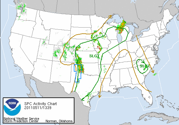
As next week dawns the activity will begin to build once again for a good chunk of the nation. A deep trough will dig into the Rocky Mountain region. Out in front temperatures will soar into the mid and upper 80s in the Plains and Midwest. Along with the heat will come the humidity thanks to the relentless rains these areas have seen over the last several weeks. Behind the front; however, very cold temperatures will set up and will likely drop snow in the Inner Mountain West and out into the High Plains. The battle between the two fronts will be the focal point for severe weather next week. Starting late Sunday in the western Plains this system will edge east over the following days bringing the threat with severe weather with it. North of a building warm front, some places could receive excessive rainfall. Where this sets up is not clear at this time but some areas that have been hit with heavy rain could be hit again.
When you have that big a clash of air masses more times than not the stage is set for a big battle which will likely lead to that severe weather threat. How violent it can become is not yet known but the chance exists for a swath of severe weather to run across the Plains, Midwest, and into the Ohio Valley. As the third map entails, as quickly as the region warms up into the upper 70s to perhaps middle and upper 80s by next weekend the region will likely fall back into the lower 60s. The bottom line is this is not a prolonged warm period of weather.
Memphis, Tennessee; Courtesy of tbertor1 (Flickr)
With flooding being a concern for certain areas this photograph is a good representation of how powerful water really can become when moving. This car appears to be dragging by the force of the water. This is why the saying “TURN AROUND DON’T DROWN” is so strongly advised. 4 inches of flowing water can knock an average human being down. A foot or so of flowing water can move most mid-sized vehicles and render them haplessly along the flow of the water. If you notice a situation like this becoming apparent move to higher ground and do not try to outrun flood waters.
By Weather Specialist Josh Ketchen


Huge follower of the website, lots of your blogposts have definitely helped me out. Looking towards updates!